ATLANTIS, ANTARTICA VE PIRI REIS
by ARKEOTEKNO
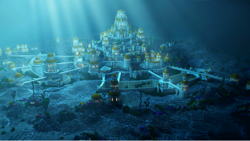
Long before the years 3200-2900 BC, in which the writing was found by Sumerians, which archeologically the beginning of the history, and the beginning of the Early Bronze Age in Anatolia, in 9600 BC, Atlantis, which was thought to be a continent, was defined as a “great” country in the “Timaeus” and “Critias” books of antiquity philosopher Platon. It was thought to be an important continent full of architectural beauties, with a community that was mostly busy with navigation and that had an advanced technique.
Today Atlantis, that has no archeological findings, is believed to have been in the place where is Antarctica now, however, some discussions are still going on; that this lost continent was hit by a comet in 3100 BC and the pieces were spread to everywhere that people combined these pieces with tin and they started the bronze age, and then another comet hit the earth in 2193 BC and in 1628 BC, Thera volcano was exploded in Santorini, in Aegean Sea and Atlantis sank into the water and disappeared forever. Archaeology relates the former event with the beginning of the Early Bronze Age and making more powerful weapons by combining tin and copper to form bronze, the second event with the decline of the Akkadian Empire, and the third one with the disappearing of the Minoan.
Later, the disappearing of the Hittites in Anatolia and that the communities like Pelets, Tjeler, Shekels, Sherden, Denyen, Weshesh and undefined others reached until Egypt because of the migration of Sea Peoples and as its result the disappearance of the writing obscurely happened after the Troy War. (1184 BC)
With this last event, the geologists accept that there have been important changes on the crust of the earth in the years of 3100 BC, 2193 BC, 1628 BC and 1184 BC. [3] It is still unknown if the pyramids in Egypt were built by being moved by the people who could escape from Atlantis before it sank into the ocean, like they tried to donate Egypt with modern architecture as they did to their own country. It seems that the claim that says some people from Atlantis escaped and they created the roots of Uighurs must be supported by archaeological findings. With these opinions, Hapgood read the book called " The Maps of the Ancient Sea Kings by Canadian Flem Ath couple, who wrote the most number of books about Atlantis, and the claim of Atlantis was today's Antarctica gained popularity with concrete evidence and took place in official international writings.
In 1513, Piri Reis drew the Antarctica continent’s 1.6-kilometer surface, which is now covered with a layer of ice, while the people did not even know that it existed until 1818. Hapgood, the professor of Keene State College wrote a letter to the USA Air Forces to have the map certified and he was surprised with the answer: “Considering the knowledge of geography in the year 1513, we do not know how it is possible to draw this map and we understand that it was drawn before the Antarctica got covered by ice."
Hapgood suggested the “gliding earth crust” idea in 1953 to answer the question of "How did the Antarctica, which is thought to be not covered with ice back then, become covered with ice by compressing the continents with the movements of the earth?". This idea was supported by Einstein.
Hapgood started to question how Piri Reis could draw the map of Antarctica, which was discovered in 1818, without the ice in 1513 and why it is covered with ice now.
Today, it is geologically established that an important part of the continent named the Queen-Maud region has not been covered with ice since 4000 BC. If so, couldn't have Piri Reis draw the map by looking at the Sumerian maps in Mesopotamia ? [2] Wouldn't this situation mean that Mesopotamian societies were not the first ones in the history and there had been other societies before them?
Despite of this idea Hapgood claimed that Atlantis, which went to the south by the earth's movements, was today's Antarctica by residing with Piri Reis's map and believed that it could have been covered with ice in the recent history. In 1559, another Ottoman citizen named Haci Ahmed, who was from Tunusia, were drawing the map of the Bosphorus between Siberia and Alaska named Bering Bosphorus with an enourmous highway. [3] V. Jonassen Bering was going to discover the America continent in 1741 for the second time, which had been already discovered in 1429. All drawn maps of Antarctica confirmed the map of Piri Reis.[4] In the maps, the iceless surface of Antarctica could be seen as a whole land and Bering Bosphorus was not there. Today, Antarctica is a piece of land used as a common scientific lab by 52 nations with an agreement [5] without being belonged to one nation, however, the discussions are still going on whether or not it was Atlantis, which had an archaeological history based on the Sumerians and Piri Reis.
ARKEOTEKNO
REFERENCES
[1]https://eduardopiperet.wordpress.com/2014/02/01/the-earth-crust-displacement-theory-by-charles-h-hapgood/ ABD Hava Kuvvetleri Subayı Yarbay Ohlmeyer imzalı mektup. Yarbay Harold Z. Ohlenmeyer, 8. Teknik Keşif Filosundan, SAC, USAF, Westover AFB, MA)
[2] Graham Hancock, Fingerprints of Gods, Crown Publishers, 1995
[3] Jim Willis, Ancient Gods,Lost Histories, Hidden Truths, and the Conspiracy of Silence
[4] French cartographer Oronteus Finaeus (1531) drew the map of the south pole in detail without the ice (ice free map) and later the maps of Mercator (1569) and Buache (1737) confirmed the map of Piri Reis.
[5] Antarctica Agreement , 1959


Sayfa Yorumları (0)
Yorum Bırakın